Tahuehueto
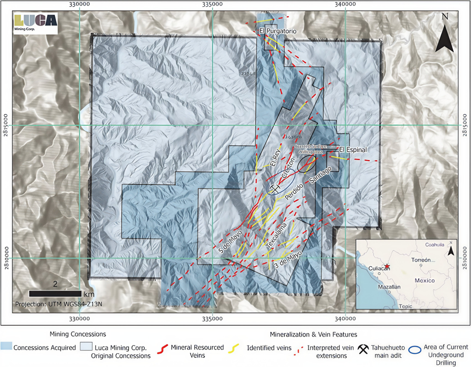
This 7,492-hectare property covers at least 12 mineralized zones hosted within a structurally controlled epithermal system that has been traced for more than 6 km.
M&I Oz Gold
M&I Oz Silver
M&I Oz Au Eq
Resources, reserves and contained metal estimates based on Preliminary Feasibility Study dated April 27, 2022
Overview
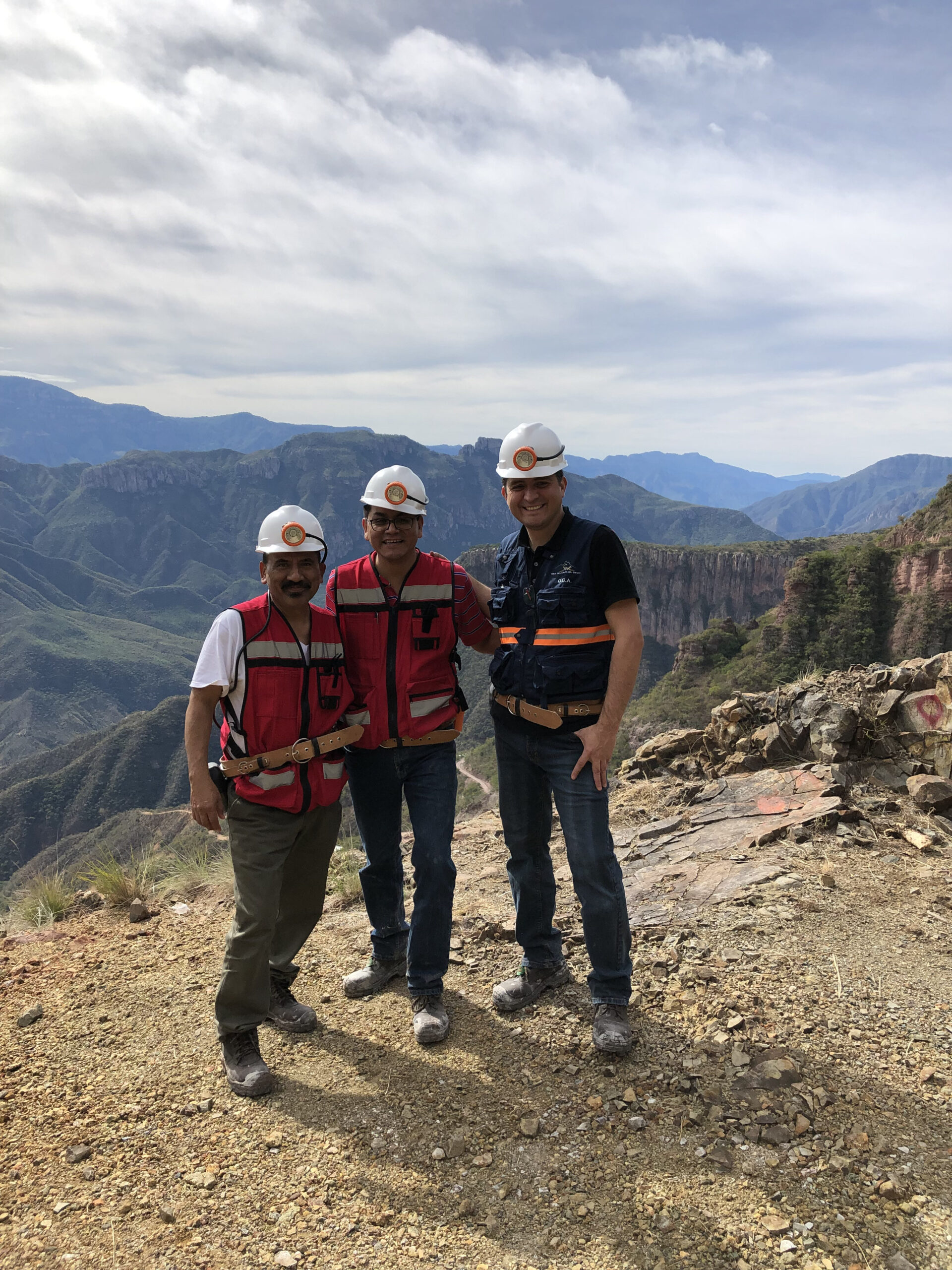
Located in Durango, México
Tahuehueto provides exposure to precious metals and excellent growth potential to the Company. It is Luca’s flagship asset, where over $ 30M has been invested between Exploration, Prefeasibility Study and Mine Development.
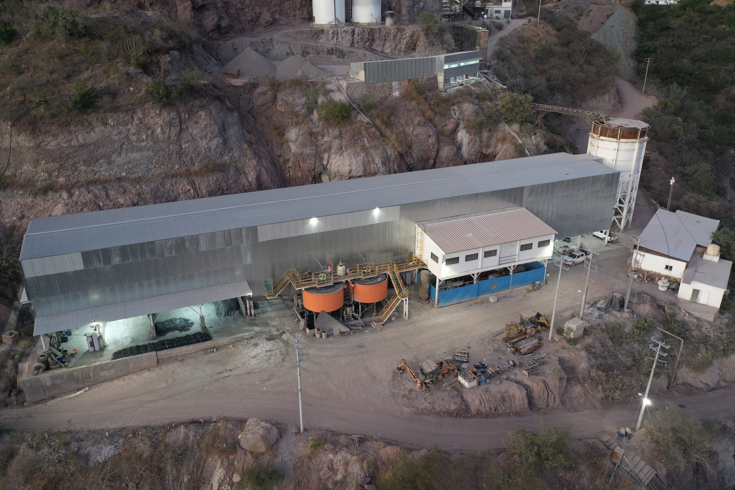
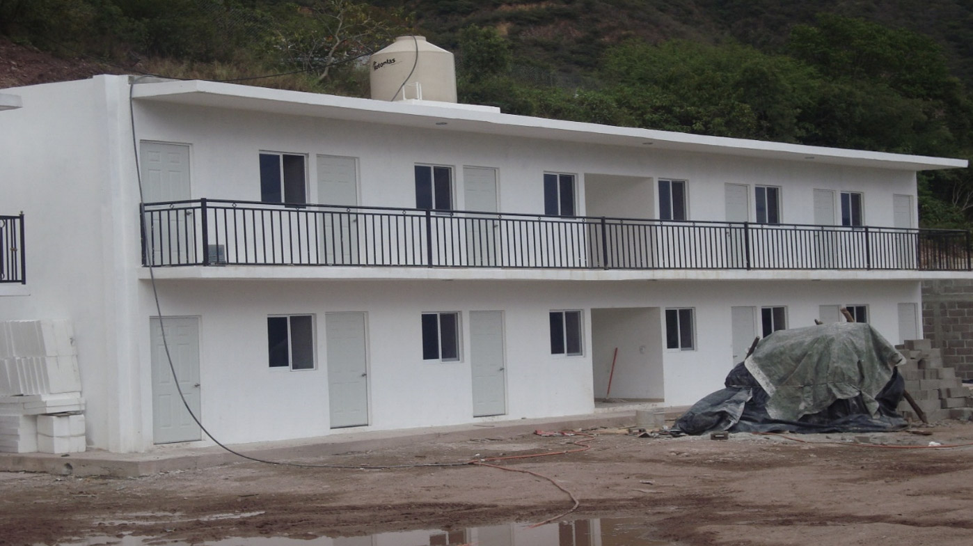
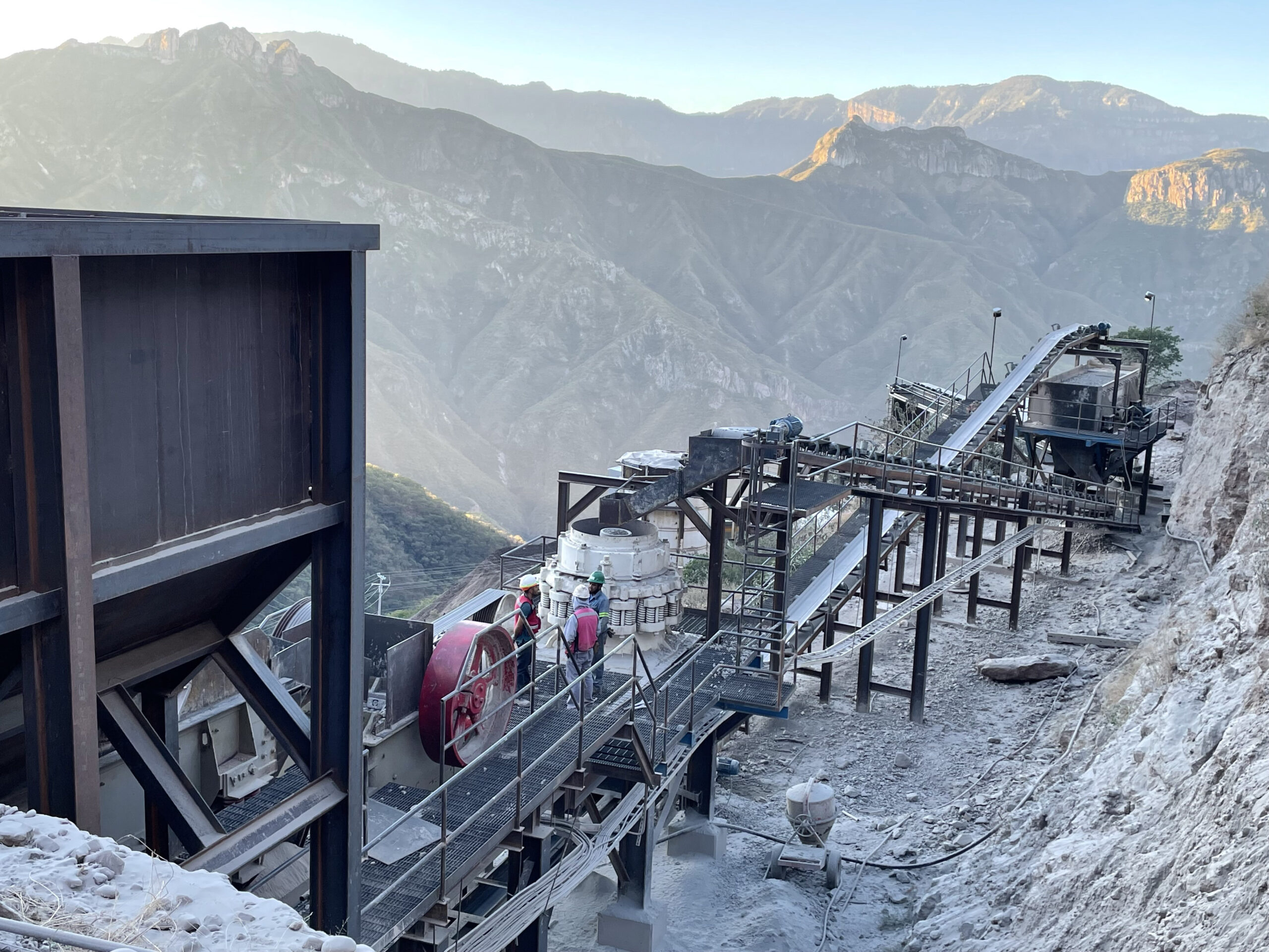
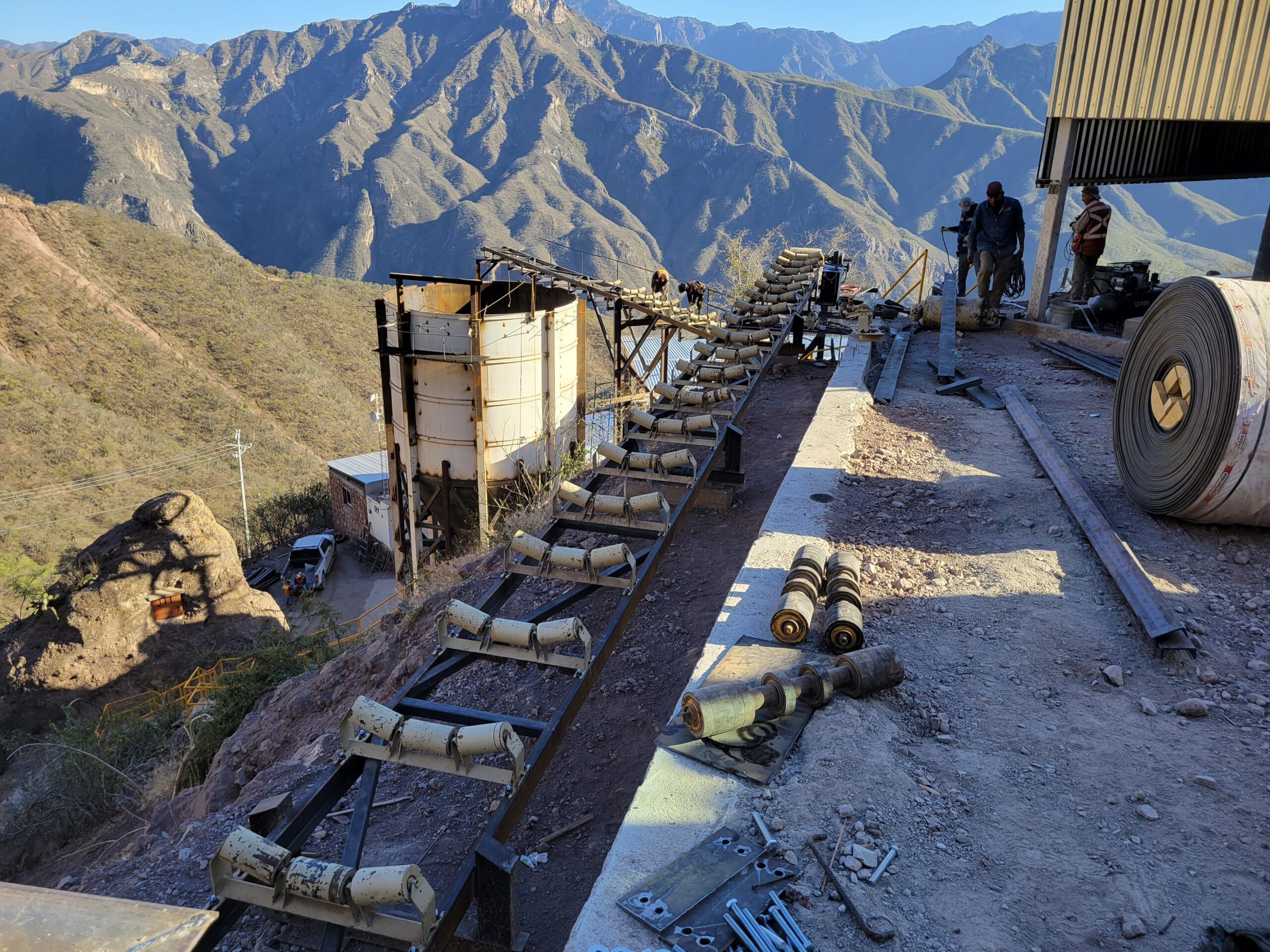
Commercial Production in 2025
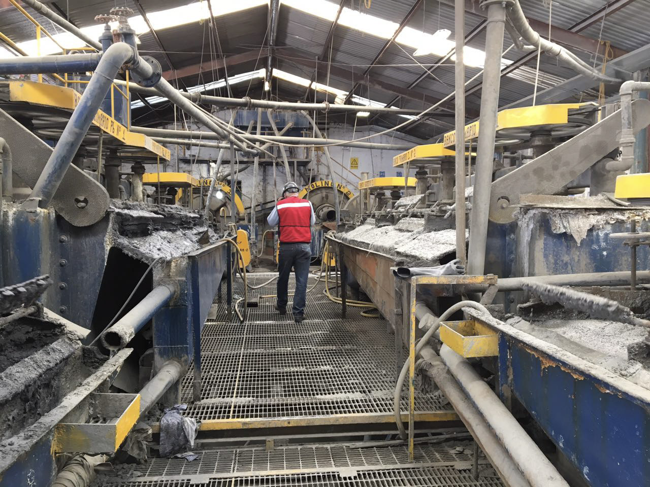
Tahuehueto’s 1000 tpd processing plant has successfully commissioned its mill and is now in commercial production.

FEATURE
Luca's New High-Grade Ore Shoots At Tahuehueto Mine, Durango, Mexico
Location & Infrastructure
The Tahuehueto project is located in the northwest portion of the state of Durango, about 250 km northwest of Durango, the state capital, and 160 km northeast of the city of Culiacan, Sinaloa. The project is located about 25 km north of the Topia polymetallic-silver mine, 40 km northwest of the La Cienega gold, silver, base metal mine, 85 km southwest of the Guanacevi silver district, 280 km southeast of the Palmarejo silver and gold mine, and 150 km northwest of the San Dimas mining district, most notable for the Tayoltita silver and gold mine. The project is approximately centered on UTM coordinates (WGS 84 Zone 13 for México) 337366 m E and 2812659 m N (106°37’1 longitude west and 25°25’19 latitude north).
The nearest sizeable community to the project area is Tepehuanes, which is located approximately 175 km by road east of the property and has a population of approximately 15,000. A 34.5 kv power line and telephone service extends as far as Tepehuanes; diesel generators presently supply power to the project site.
Resources & Reserves
Mineral Reserve Estimate
Classification | Tonnes (x1000) | Gold | Oz Au (x1000) | Silver | Oz Ag (x1000) | Copper | Lbs Cu (x1000) | Lead | Lbs Pb (x1000) | Zinc | Lbs Zn (x1000) |
|---|---|---|---|---|---|---|---|---|---|---|---|
Proven Reserves | 2,538 | 2.89 g/t | 219 | 51.93 g/t | 3937 | 0.27 % | 14,246 | 1.18 % | 61,429 | 2.07 % | 107,515 |
Probable Reserves | 1,227 | 1.90 g/t | 75 | 46.48 | 1,834 | 0.23 % | 6,304 | 0.96% | 25,929 | 1.63% | 44,125 |
Canadian Institute of Mining, Metallurgy and Petroleum standards were followed in the estimation of the Mineral Reserves. Mineral Reserves were estimated using metal price forecasts of $0.92/lb for lead, $1.14/lb for zinc, $3.60/lb for copper, $1,647.05/oz for gold and $21.64/oz for silver. Totals may not add due to rounding. The foregoing mineral reserves are included within the current Mineral Resource Estimate for the Project.
Measured & Indicated Resources
Classification | Tonnes (x1000) | Gold | Oz Au (x1000) | Silver | Oz Ag (x1000) | Copper | Lbs Cu (x1000) | Lead | Lbs Pb (x1000) | Zinc | Lbs Zn (x1000) |
|---|---|---|---|---|---|---|---|---|---|---|---|
Total M&I | 6,260 | 2.11 g/t | 425 | 46.97 g/t | 9,454 | 0.27 % | 36,594 | 0.90 % | 123,872 | 1.98% | 273,364 |
Measured | 3,875 | 2.42 g/t | 302 | 48.54 g/t | 6,047 | 0.27 % | 23,215 | 1.11 % | 94,9667 | 2.01 % | 171,481 |
Indicated | 2,385 | 1.60 g/t | 123 | 44.43 g/t | 3,407 | 0.25 % | 13,379 | 0.55% | 28,905 | 1.94% | 101,883 |
Inferred Resources
Classification | Tonnes (x1000) | Gold | Oz Au (x1000) | Silver | Oz Ag (x1000) | Copper | Lbs Cu (x1000) | Lead | Lbs Pb (x1000) | Zinc | Lbs Zn (x1000) |
|---|---|---|---|---|---|---|---|---|---|---|---|
Inferred | 918 | 1.02 g/t | 30 | 28.46 g/t | 840 | 0.15 % | 3.077 | 1.16 % | 23,571 | 1.96 % | 39,755 |
Note: The above mineral resources have been calculated using a cut-off of 1.35 g/t Au Equivalent. These resource numbers are preliminary in nature. They include inferred mineral resources that are considered too speculative geologically to have the economic considerations applied to them that would enable them to be categorized as mineral reserves. Resources, reserves and contained metal estimates based on Preliminary Feasibility Study dated April 27, 2022
Geology
Regional Geology
The Tahuehueto project lies near the western edge of the Sierra Madre Occidental, a 1,200 km long north-northwest-trending volcanic plateau that is 200 to 300 km in width. This mountainous plateau separates the southward extension of the Basin and Range Province of the southwestern United States into two parts; Sedlock et al. (1993) suggested calling these two areas of extension the eastern and western Mexican Basin and Range provinces. Tahuehueto is near the boundary between the Sierra Madre Occidental and western Mexican Basin and Range Province.
Property Geology
The property contains four main rock types: lower volcanic series andesite, granodiorite stocks, polymictic conglomerate, and felsic ash-flow tuffs of the upper volcanic series. The majority of the project area is underlain by andesite flows, tuffs, and volcaniclastic rocks of the lower volcanic series.
The lower volcanic series remains generally undifferentiated. A volcaniclastic unit distinct from the andesite flows exists in the Texcalama and Cinco de Mayo areas and an andesite lithic lapilli tuff exists in the footwall of the El Creston structural zone. Granodioritic stocks intrude the andesites and are exposed at surface in the footwall of the El Creston structural zone and the El Rey mine area.
The andesites and granodiorite are overlain by a basal polymictic conglomerate unit that is tens of meters thick and marks the unconformity between the lower and upper volcanic series. Amygdaloidal basalt flows occur locally within the conglomerate unit. In some areas, thin units of ignimbrite were deposited before the conglomerate. Late Tertiary or Quaternary landslides obscure outcrop patterns in the El Creston-El Perdido area and are likely to be present in other areas of steep topography within the project area.
A series of northeast-striking veins that formed within a series of normal faults with subordinate left-lateral displacement hosts the Mineral Resources described in Section 14. The principal, through going veins have a general strike of 045° to 060° and dip between 65° and 80° to the southeast. This vein set includes Cinco de Mayo, El Catorce, and El Perdido and extends northeastward to Santiago. Other veins with the same orientation include El Rey, Dolores, Tahuehueto, Texcalama, El Espinal, and Tres de Mayo. Within the core area of the Mineral Resources, the El Creston series of veins, striking about 035° and dipping 60° to 80° east, formed in a strongly dilatant zone between the through-going El Perdido and El Rey structures.
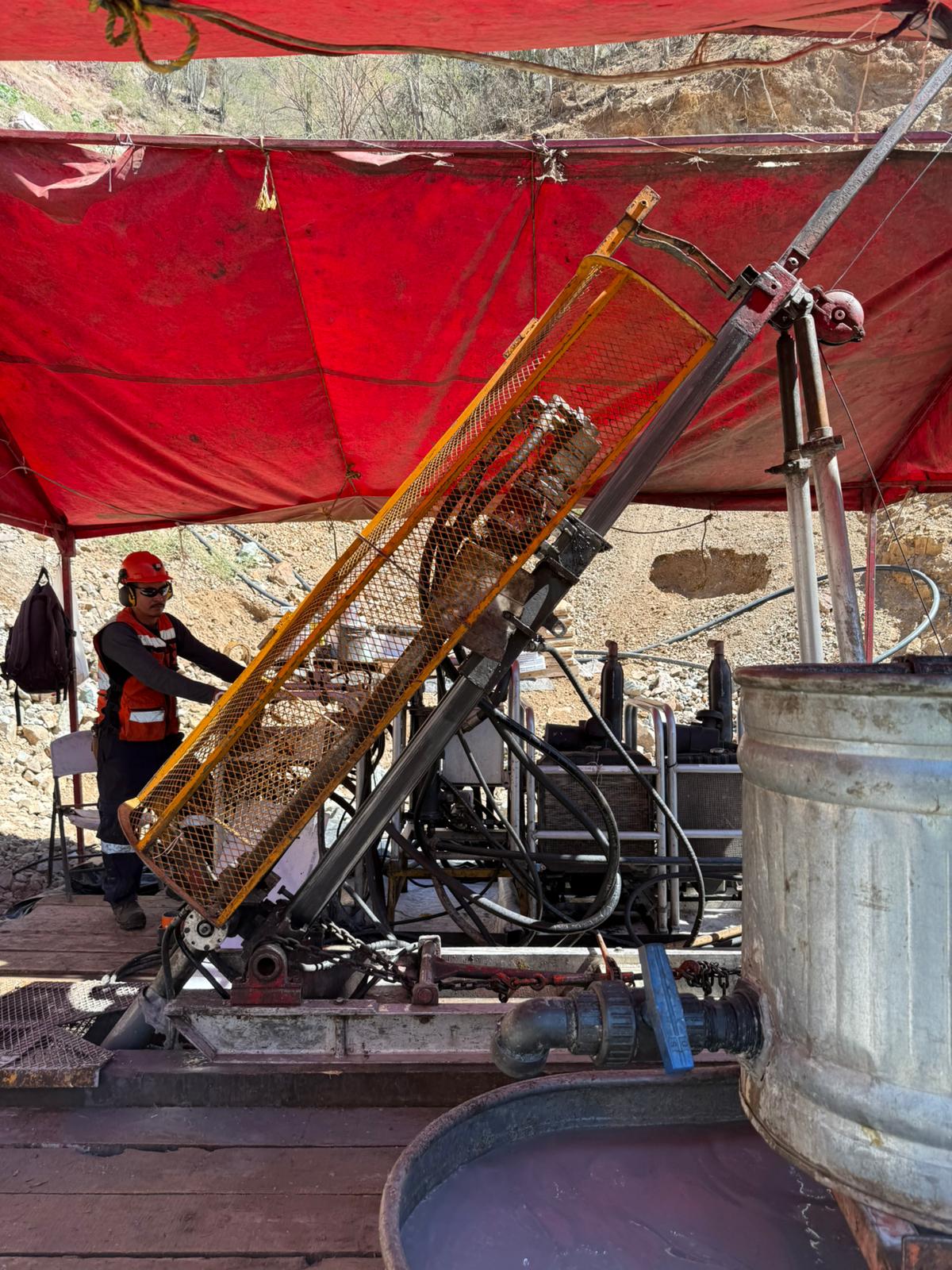
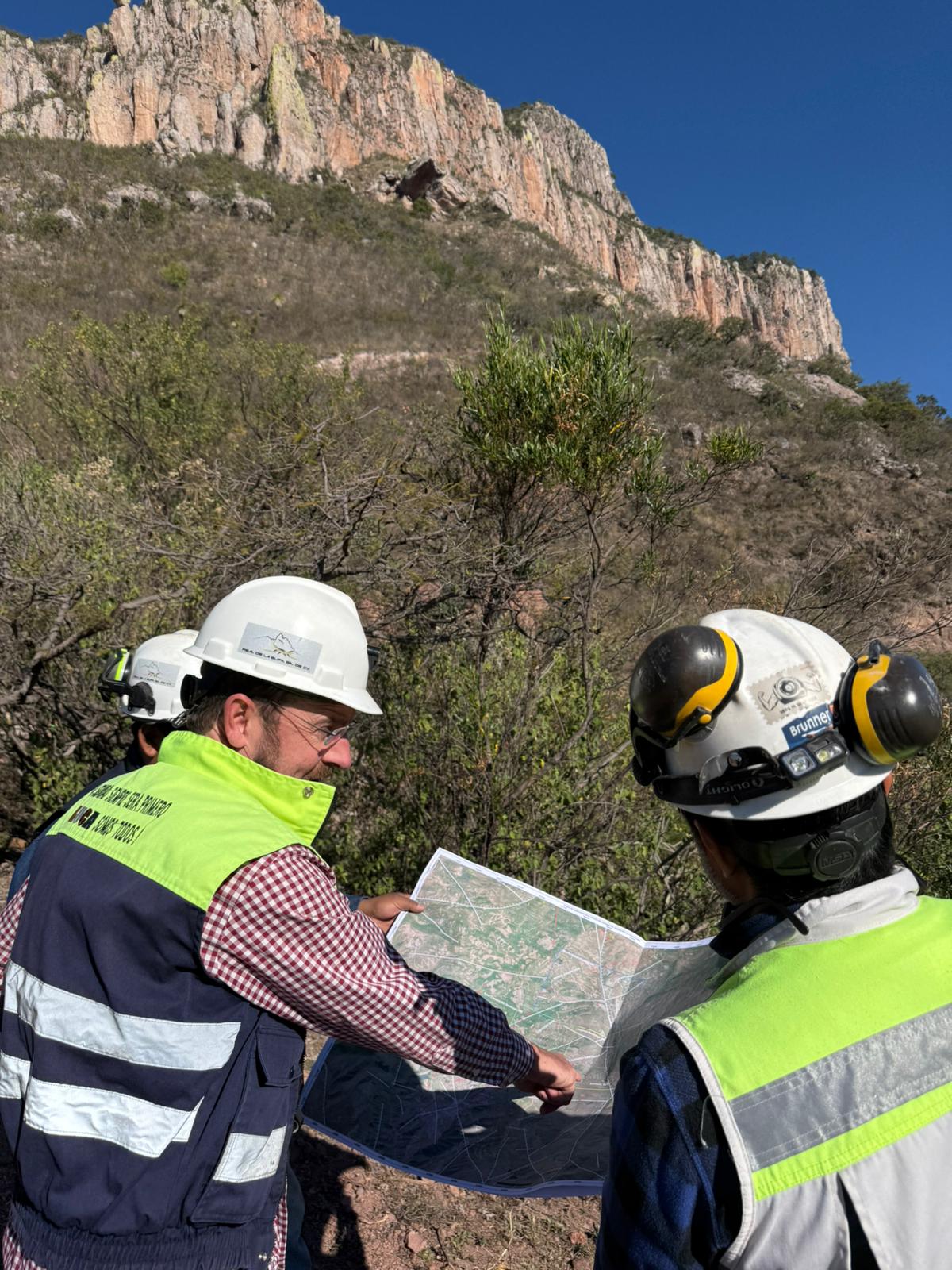
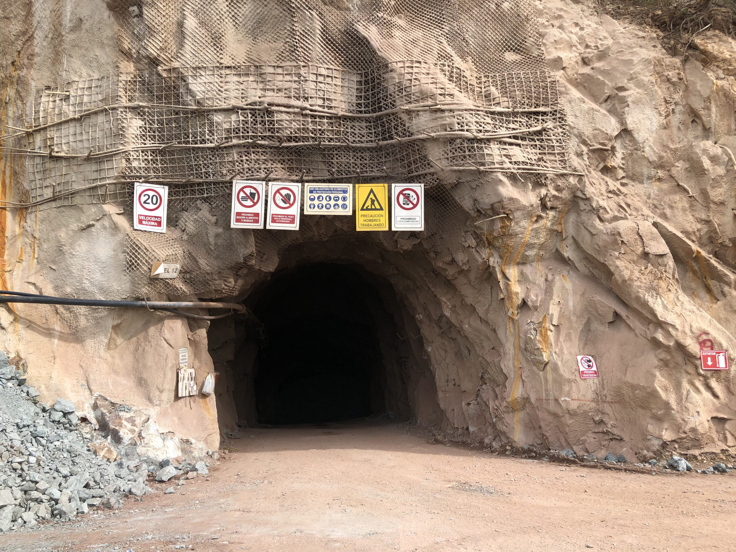
Exploration
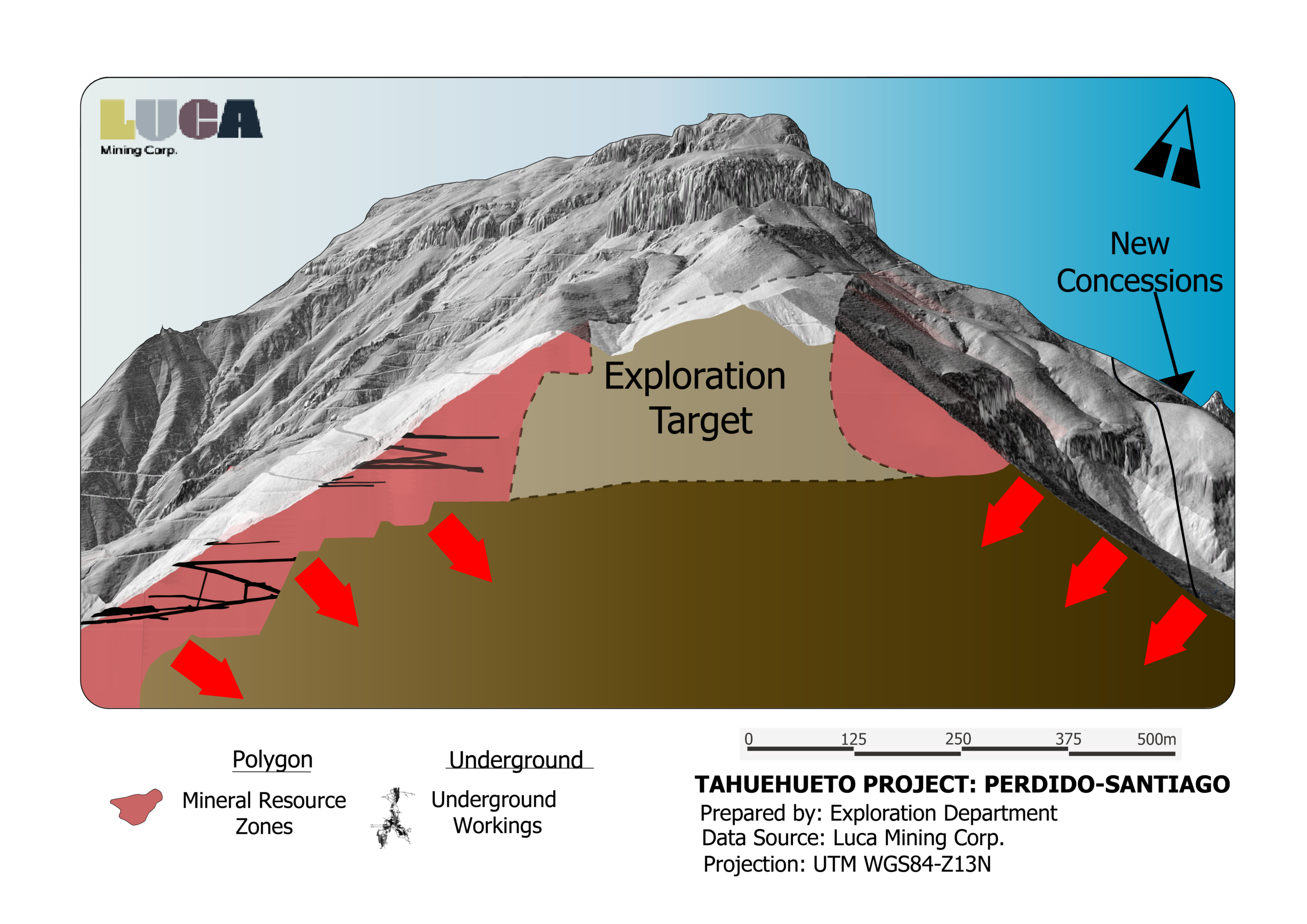
Tahuehueto is a district-scale epithermal gold-silver system hosting approximately 11 kilometres of prospective vein structures. The property is supported by a substantial historical exploration database, including approximately 48,260 metres of drilling completed in 252 drill holes between 2004 and 2011.
Luca restarted systematic exploration at Tahuehueto as part of its three-year, US$25 million exploration program. Current exploration is focused on near-mine resource expansion and mine-life extension through the systematic testing of known mineralized structures, while also evaluating selected targets across the broader property. Drilling is designed to extend mineralization along strike and at depth within existing mining areas, where multiple vein systems remain open and continue to demonstrate strong growth potential.
Recent drilling results continue to advance key targets across the property, particularly within the Creston, Santiago, and El Rey vein systems, confirming the potential to expand known mineralization and enhance the long-term production profile of the operation.
Recent Exploration Highlights
- Multiple high-grade drill intercepts were returned from recent drilling, including 7.6 metres grading 16.08 g/t AuEq and 5.4 metres grading 16.00 g/t AuEq, in the Creston vein.
- Also from the Creston vein system, drilling returned high-grade mineralization, including 6.8 metres grading 5.54 g/t AuEq, with narrower intervals grading up to approximately 16 g/t AuEq.
- High-grade breccia ore shoot discovered within the El Creston vein system, returning 9.4 m of 5.21 g/t AuEq within a broader 13.9 m interval of 3.90 g/t AuEq.
- Santiago returned 14.0 m grading 6.68 g/t Au and 6.0 m grading 9.0 g/t Au, marking the first drilling at the deposit since 2008 and extending mineralization by >100 m along strike.